Tadiandamol - Highest Peak

Tadiandamol - Trekking Adventure
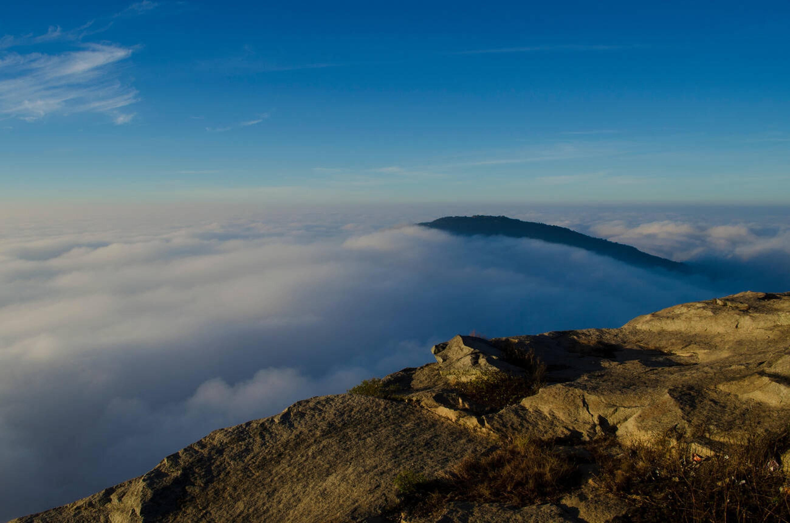
Tadiandamol - Sunrise Views

Tadiandamol Peak
Coorg's Highest Peak at 1,748 Meters
Loading Tadiandamol Peak...
Tadiandamol - Highest Peak
Tadiandamol - Trekking Adventure
Tadiandamol - Sunrise Views
Coorg's Highest Peak at 1,748 Meters


Watch these amazing YouTube Shorts from visitors and content creators showcasing the beauty of Tadiandamol Peak
Tap to load video
Tap to load video
Tap to load video
Trekking Adventure
Click to load
Amazing experience
Highest Peak
Click to load
Amazing experience
Sunrise Trek
Click to load
Amazing experience
Tadiandamol Peak stands majestically at 1,748 meters above sea level, earning its title as the highest peak in Coorg and the second-highest in Karnataka. This magnificent mountain is part of the Western Ghats range and offers one of the most rewarding trekking experiences in South India, combining challenging terrain with spectacular natural beauty.
The name 'Tadiandamol' translates to 'Tadiyanda' (the third) 'mola' (mountain peak), reflecting its position in the regional mountain hierarchy. This pristine peak is surrounded by lush forests, rolling hills, and offers panoramic views that stretch across the entire Coorg landscape and beyond into Kerala's mountain ranges.
The trek to Tadiandamol is approximately 6 kilometers long and takes 3-4 hours to complete one way, depending on fitness levels and weather conditions. The trail begins from Kakkabe village and winds through dense shola forests, grasslands, and rocky terrain, offering diverse ecosystems and stunning viewpoints along the way.
The trek is considered moderate to challenging, with steep ascents, rocky patches, and potential weather changes. However, the effort is rewarded with breathtaking sunrise views, 360-degree panoramic vistas, and the satisfaction of conquering Coorg's highest point. The summit offers unobstructed views of the Arabian Sea on clear days.
Kakkabe Village
Trek starting point
Distance from Madikeri
35 km (1 hour drive)
Trek Distance
6 km (3-4 hours one way)
Difficulty Level
Moderate to Challenging
